Showing posts with label national park. Show all posts

Tuesday, 12 May 2015

A long walk in the Peak District- Castleton to Hayfield

I had one of those long weekend walks through the Peak District that made me happy that I made all the right choices in life that led me to be there.  

A mere two hour train ride north of London, sandwiched between the bustling metropolises of Manchester and Sheffield with a load of other populous cities in the midlands within an hour of the boundaries, The Peak District is the first area given National Park status in the UK and the second most visited National Park in the world.   Only Mount Fuji in Japan has more visitors.  Last year, Google had a nice google-doodle to celebrate the anniversary of it becoming  parkland.  


It took me more than a year later after seeing that to get here though.  I'm a bit spoiled for choice when it comes to choosing a walking weekend here.  

We took a train to Sheffield and then switched to a small two-carriage diesel affair.  A 4-mile long tunnel under the hills separates the urban sprawl to the park nicely, and we emerged from the dark in a whole new landscape of hills and farms and valleys.  

We disembarked in the town of Hope and made our way on foot to Castleton the long way- instead of taking the road directly, we walked up the hillside and took a much longer trail past Roman ruins and through sheep fields.  
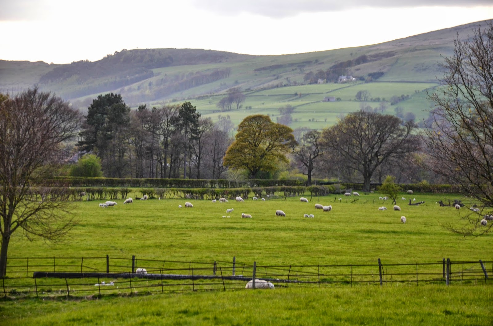


The fact that it doesn't get dark until very late now is a joyfully good time for walking.  Putting in four miles after a two hour commute was a nice stretch before bedtime.


We got to the hostel and bunked down for the night.  I just want to applaud the YHA for everything they do.  Yes, it's bunk beds, but they have a lot of really beautiful properties, very few of them purpose-built.  The YHA Castleton was an old manor home on beautiful parkland nestled in a valley with hills all around.  What a treat to stay there, even if it's in a bunk in what used to be the stable.  The common areas retained their character and there was a lovely library to explore.  I would come back any time and we would have stayed longer and used it as a base but it was only available the one night.  Also, it's cheap as hell to stay.  Even a private room will set you back much less than a B&B, and you always meet nice people in the common rooms and at breakfast.


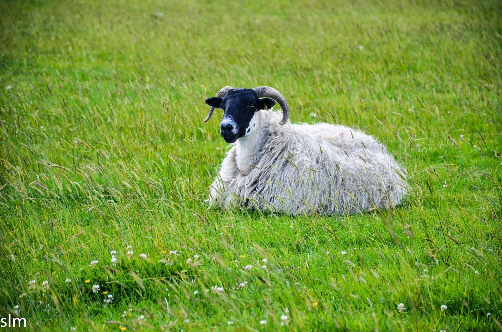
We set out early.  Lucky us, the trail up loose hill is right in the back yard.  But first, we would have to get past lambs, lambs and more lambs, which takes me quite some time to walk past.


I think the border Leicester sheep win awards for being the goofiest looking of the lambs.  Their oversized ears make them look like they are trying fly.


Finally, passed the undeniable cuteness, we started the long climb up Loose Hill to tackle what is reputed to be the finest ridge walk in the Peak District.


and here it is:


Ridgeline walks are always my favorite here.  The views, the easy walking after a big climb up.

THE WIND.  Oh, gawd, the wind.  It was windy.  Fiercely so.

Even though we obsessively checked the forecast, we weren't thinking it was going to rain until the next day.  Alas, as soon as we got to the top of Loose Hill, big wind-driven drops began to splat on our hoods.

The views from the top though.  Ahh, the next valley over contained the biggest climb in the Peak District:  Kinderscout, the legendary bog-topped hill that inspired a mass trespass that turned this into a National Park.  


The wind and rain didn't seem to deter too many, and towards Mam Tor, we were sharing the trail with dozens of people and dogs and mountain bikers.


In the valley below was Edale, a town quite popular with walkers, as this is the start of the Pennine Way trail.  This was the first official National Trail in England, an answer to the Appalachian Trail in the states.  It's the stuff of nightmares: everyone who has walked it tells stories of bogs, bogs and more bogs on the 268 miles from Edale to the Scottish Borders, following roughly the Pennine Watershed the entire time.


 After a warming lunch at the Penny Pot, a cozy National Trust cafe near the Edale train station, we stopped at the visitor's centre and headed to the start of the Pennine Way.  Already having hiked 7 miles, I thought we would be well behind the crowd, but dozens of people had set out with us.

And yes.  There is a pub at the start of the trail.


Wainwright, the grandaddy of all ramblers in the UK, famously complained about how miserable this trail was, and he was a tough old nut.  Bogs.  So many bogs.  Rain, let's pray for not a sunny day (too much to ask!) but a less-than-soaking rain.  A drizzle perhaps.  He famously said, "I hope you enjoy your walk on the Pennine Way...the walk will do you good.  You won't come across me anywhere along the Pennine Way.  I've had enough of it."


So perhaps it was the most appropriate way to start the trail with the sound of rain beating against my be-hooded ears.


Away we go!

The official trail skirts around Kinderscout before switchbacking up the western side of it.  The top of Kinderscout has been the stuff of nightmares for many people.  A big, flat bog on the top, with no obvious landmarks.  It's easy to sink up to your armpits and lose your sense of direction in the mist up there.

I would normally be all up for an adventure, but the wind was really whipping.  Staying on the good trail became the best idea.

Soon, the rain got bad enough for me to have to put the camera away in a dry bag.


I took it out from time to time to capture a quick shot, but it stayed safe for the rest of the day.


The most astounding this was Jacob's Ladder- a well-paved steep set of switchbacks very early on in the trail.  Here was the line of people going down as we were going up:


 It was some pretty epic people watching.  We saw dozens of people not wearing rain gear.  Jeans, flimsy tennis shoes, sodden sweatpants.  People carrying or bribing small crying children to just take a few more steps.  One large-bottomed woman was more or less being carried down Jacob's ladder by her entire family.  Yeah, they didn't forecast rain.  Honestly, my heart (and wallet) goes out to the Mountain Rescue people here.  They probably get more than their fair share of stupidity rescues.

We followed the trail to the top of Kinderscout and took shelter in a blissfully protected Tor near the top.


With nothing but our eyes and noses peering out of our hoods and our hands starting to go numb, we fumbled with the maps.  Instead of taking a long walk on top of Kinderscout to Kinder Downfall (the highest waterfall in the UK) we decided to get off the ridge and our of the wind and head down to our pub.  It seemed like we were quitting, but it was still a 4 mile walk to warmth, and we began our long trek into the next valley.


Once we left the top of Kinderscout, we didn't see another person for the rest of the day on trail.  It was getting crowded up there.


I had found a cozy roadside pub in the hamlet of Little Hayfield.  With Kinderscout on one side and more hills on the other, I figured it would make a nice basecamp for a couple days.  Plus, if it rained, we didn't have to go out in it to get to our next destination.  It was really stark and beautiful to slog across the moors with the occasional red grouse being scared out of its hidey-hole in the heather.

It was fantastic to get in, shed the sodden clothes (because even waterproofs won't keep you dry when you are out there for hours)  warm up with a hot bath and then sit by the fireplace with a whisky.  Despite the weather, we did over 16 miles of walking, most of it exposed to the wind.  Sleeping well is about the only thing I can do at the end of the day.

Monday, 14 July 2014

Hadrian, Day 2: The Cows Continue to Freak me Out, and we Walk to Twice Brewed


Woke up, asked politely for a vegetarian breakfast, ended up getting a half pound of bacon fat dripping off my plate anyway.  Sigh.  I try.  At least there was coffee.  

Boots on, ready to go.  I started to cross the first cow field of the day but ended up tiptoeing past with wide eyed suspicion.  

Cows....


Lining up to graze in a Stonehenge-type formation is not cool.  Using the sheep as sarasens.  NOT COOL, COWS.  Have you ever seen them do this?  I don't think I've ever seen them so orderly.

Off to sunnier happier thoughts.


Thriwall Castle, a lovely old ruin.  It was built in the 12th century.  Hmmmm, what happened to that Wall that was running past here?


The castle is built from Wall Stone, and was abandoned in 1748.  While not a huge grand castle, it was probably quite a cozy family home, and it's a ghostly site on the trail.


I had planned the trip to allow plenty of time to check out various ruins and museums along the way, and I'm happy I did.  Although, the Roman Army Museum is right on the trail but they didn't open until 10am, making it fairly useless to ramblers wanting to get to their destinations before dark.


Just ahead of the museum, there is a parking lot and a lot of day-trippers get out to climb to the top of the quarry to get a view of the wall, including this angry huffing man in a kilt.


I was racing ahead, trying to get well in front of a very noisy busload of college-age kids and their guide, but happily, they stopped for a photo op at the top of the hill and hiked no more.  The trail opened up across the first sizable hills of Walltown Crags.


The views up here were fantastic, and clear enough to see all the way into Scotland.  Most of this day was hiking through Northumberland National Park.


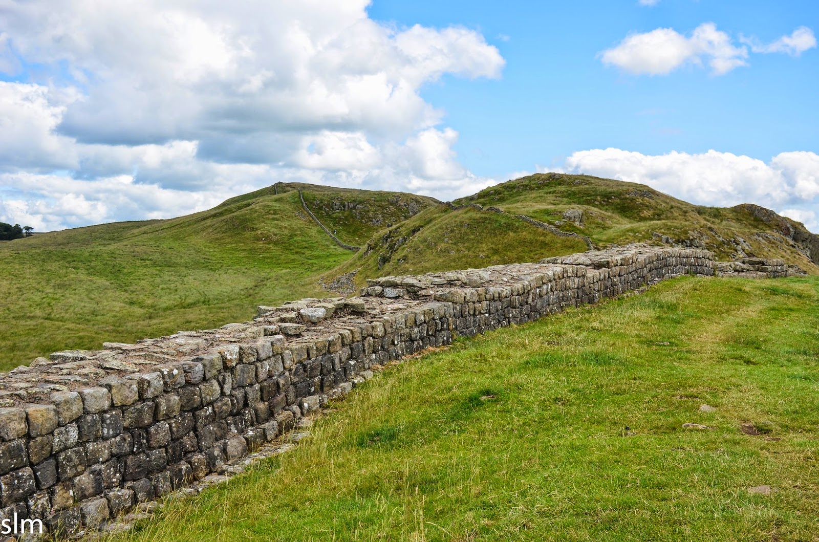
Here is the best preserved parts of the wall.  It follows a hilltop ridge pretty much unbroken for many miles.  The stone was hard to get to up these steep hills, and fewer people in this part of the country to scavenge from it, so it was basically left alone.  While it's suffered and isn't as tall as it once was, it is impressive in its size and scale none the less.  Well, considering it was built in 122 AD, so you expect some wear and tear.
 

The hills were steep (well, you know, for England), and it was fairly challenging.  While the path was grassy and easy on the feet, there were lots of steep climbs and vertiginous plunges.


Ahead, many more miles of craggs and hills to conquer filled the horizon as the trail drifted south.


There is also a Roman military road that runs along the south side of these hills.  It would have been impracticable to have a supply road running up and down the crags, so they built a low road to go around it.  You can still hike it as it is a public footpath; if you don't feel for hills you can do as the smarter Romans did.  

Although the temperatures were cool and perfect for hiking, it was sunny and very windy.  If I stopped too long for a break, I'd have to layer up in wool while slightly shivering.  I love places where heatstroke in July is no concern at all.


Parts of the wall, lower on the hills looked a mess, with barely a wall at all:


The trail took us through a pasture filled with Shetland ponies.  These diminutive but strong beasts were created to pull carts of coal around the mining tunnels, and in the past, many never saw the light of day their entire lives.  Now they are re-purposed as childrens' ponies, but as anyone who had to endure them as a child will tell you they are bratty as hell.  I'm talking about you, Snip.    

'


Another quarry.  This one apparently had Roman graffiti of a phallus carved into the walls.  My impression of the Romans is they were all teenage boys.  


There were quite a lot of people on the trail, but by afternoon, they started to thin out a bit.  Which was welcome relief for me as there weren't a lot of places to pee trailside.  Thistles were about as much coverage as I could find to duck behind.    


At one point, I looked over the lonely barbarian side of the wall and pointed to a farmhouse.  "That's our hotel" I said, as there was no place else it could be, and it was.


It was still early in the day, so we decided to go the opposite way of the B&B and head on down the hill to the hamlet of Twice Brewed, which had nothing to do with beer except that they do have a pub there.


From here, we took a country lane another two miles to Vinolanda, a Roman fortified village that is now a major excavation site and museum.  Along the road which paralleled the wall, we had beautiful views of the hills and the wall that ran along the top.  Also, I found out later that if we would have stayed on the trail a bit longer, we would have come to the Roman road which would have brought us directly to Vinolanda without much actual paved road walking to deal with.


That's Sycamore Gap, an iconic part of the Wall trail:


Vinolanda is worth the detour and the price of admission.  If you are inclined, you can sign up to excavate with the resident archaeological team, which did seem like a lot of fun.  


Along with the ruins of the fort and village, there was a rebuilt section of what Hadrian's Wall would have looked like in its original form, and a fantastic museum with a great deal of the dug-up finds.  Most of it was junk that Romans had thrown over the fort wall into a ditch as rubbish: worn-out shoes, broken pottery from France, writing tablets and coins, broken bits of weaponry.  Pieced together, it gives archaeologist a pretty good idea of what life was liked for both soldiers and civilians at this lonely end of the frontier outpost.


They seemed to live in relative luxury and comfort compared to the crofters who farmed here in later centuries.  Heated floors, sewage systems, bath houses, solid granaries, relative security from the outside world.


We stayed until they closed at 5, and I was quite thankful that they let us ditch our heavy packs in a store room while we wandered the site and sat in the sunny tea room for a civilized cup.

Back on the trail: we had to walk the two miles back to Twice Brewed, stopped for a quick pint at the bustling pub there, and then back over the hill to Saughy Rigg, the farm/b&B where we were staying the night.  Our museum visit tacked quite a lot of road walking miles onto our already long day of hiking, but the sun was out and it was just so lovely and interesting, I couldn't even fathom a complaint.


Plus, there was something so charming about staying on the Barbarian side of the Wall.  Like, they probably serve you tea with their bare hands or something, and just throw down Turkey legs on the unlaid table for you to politely nibble on while Vikings rifle through your luggage.


It actually ended up being the best dinner we had on the trail, with a properly trained chef at the helm and good quality ingredients.  I'd most certainly eat a shoe after a day of walking, but it was really nice to have something other than pub food.  The B&B was cozy, and they had probably 8 rooms, most of them filled with fellow hikers, one of which was walking the trail with his guide dog and a total lack of vision.


I went out for a little post-dinner stroll to catch the sunset, but alas, these northern summer sunsets stretch way too late in the evening for me after such a long day.